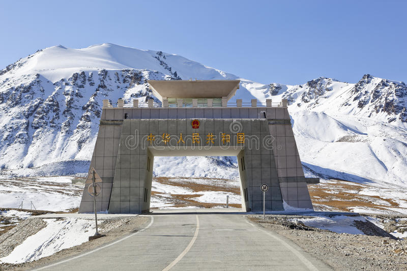
The Khunjerab Pass is the highest paved international border crossing in the world and the highest point on the Karakoram Highway. The roadway across the pass was completed in 1982, and has superseded the unpaved Mintaka and Kilik Passes as the primary passage across the Karakoram Range. The choice of Khunjerab Pass for Karakoram Highway was decided in 1966: China citing the fact that Mintaka would be more susceptible to air strikes recommended the steeper Khunjerab Pass instead.
On the Pakistani side, the pass is 42 km (26 mi) from the National Park station and checkpoint in Dih, 75 km (47 mi) from the customs and immigration post in Sost, 270 km (170 mi) from Gilgit, and 870 km (540 mi) from Islamabad.
Khunjerab Pass (sometimes called Khunerjab Pass) is a high mountain pass on the northern border of Pakistan with China, at an elevation of 4.733 meters (15,528 feet) above the sea level. The Khunjerab Pass is the highest border-crossing in the world and the highest point on theKarakoram Highway.
Khunjerab Pass is located in the Karakoram Mountains in a strategic position on the northern border of Pakistan’s Gilgit–Baltistan Hunza-Nagar District on the southwest border of the Xinjiang region of China. For comparison, Mont Blanc, the tallest mountain in Western Europe, is 4.810 m and Mount Whitney, the highest point in the 48 contiguous United States, is 4.421.
This section of the road was completed in 1982 and is possibly the highest metalled border crossing in the world. On the Pakistani side, the surface of the road is gravel. On the Chinese side, the surface of the road is a bad asphalt.
